Thursday, 29 November 2012

Nearly finished surveying Turbot Bank…

Over the last two days we’ve focused on finishing the grab samples and drop camera transects.  On Wednesday, faced with winds from the north and a northerly swell, we were limited to running multibeam lines across the Turbot Bank area for the first part of the day. Due to the size of the site and the fact that we could only run lines in one direction, it took the first seven hours of the day to complete just three! The screengrab below shows some of the raw multibeam bathymetry data. The data show a depth range across the survey area of 80 metres (in the north) to roughly 60 metres (in the central area).

Screen grab of multibeam data. Note: To increase data coverage, further survey lines will be completed in due course.

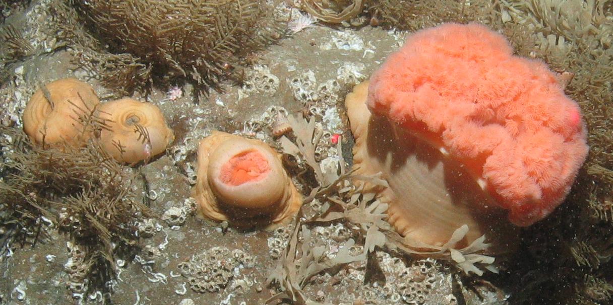
Throughout the rest of Wednesday and some of Thursday, the day and night shifts shared the effort of grab sampling and sieving.  There was a collective sigh of relief when the final grabs were processed. We were able to use the remaining contingency time to complete some extra drop video tows. In order to facilitate the interpretation of the multibeam backscatter data, the video tow stations were positioned to intersect with the multibeam survey lines. The backscatter data show the sound energy reflected back from the seabed and this can be linked to the physical properties that make up the sediment (see image below; energy values are shown using a grey scale). On the screen grab below, the darker areas indicate higher reflectance.  The video tows confirmed our predictions that the darker regions were indicative of gravel dominated substrates while the lighter areas were indicative of sandier substrates. 

Screen grab of multibeam backscatter data. The darker areas indicate relatively high sound energy reflectance.

With our survey time at Turbot Bank coming to an end, we’re getting ready for our final transit home in the early hours of tomorrow morning.

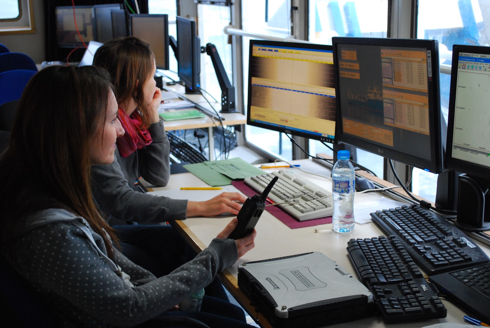
A shot of the day shift team in the plot lab…

Wednesday, 28 November 2012

The boat that rocked

Today has involved a mixture of survey methods, with the early hours involving finishing the remainder of the priority grab sites. The next task of the day was to focus on getting video footage from a subset of those areas from which we had already taken grab samples. The visibility at this survey location is really good and we could get a clear picture of the seabed. The sediment here ranges from coarse sand with the odd pebble or cobble to much coarser gravelly sediment with boulders. There is a lot of Hornwrack (the bryozoan Flustra foliacea)  growing on cobbles and pebbles in the sediment as well as cushion stars (abundant Porania pulvillus but also Hippasteria phrygiana which apparently is rather rare in British waters) urchins, anemones and plenty of squat lobsters and crabs. The squat lobsters and crabs were especially prevalent in the areas containing cobbles and boulders.
 Dahlia anemone Urticina felina 

 Edible crab Cancer pagurus and Flustra spp.

Plumose Anemone Metridium senile

 Red Gurnard Aspitrigla cuculus

Seven armed starfish Luidia spp.

Starfish Henricia spp.

Starfish Hippasteria phrygiana

Sunstar Crossaster papposus

The day shift continued with the camera tows. We also planned some supplementary multibeam lines, in case we got some rougher weather which was forecast to arrive towards the end of the day. The four ‘corridors’ of additional survey lines ran in a north-south direction and supplemented the east to west survey lines, providing a grid of acoustic data. The new lines were placed across many of the planned drop-down camera tows and Hamon grab stations within the area. Due to the sheer size of the site, it won’t be possible to get full acoustic coverage….that would take many days of intensive multibeam survey. The intersecting lines that we have planned should nevertheless provide a set of acoustic data which are representative of the area. Towards the latter part of the day, the wind picked up and the sea became a little too rough to use the Hamon grab, so we switched to the planned multibeam lines to finish off the day. 

Tuesday, 27 November 2012

Sieved to see another day…

When the night shift took over at midnight, the weather was still a little too rough for anything other than multibeam and so we continued to run some acoustic lines from East to West. The Turbot Bank survey site is large in comparison to the cSAC sites (nearly 30 times bigger than the Braemar and Scanner cSAC sites combined). Good quality data could only be gathered when the vessel travelled in one direction, with each line taking nearly two  hours. Just before sunrise we deployed the drop camera and found a number of interesting species. Some of the highlights have included squat lobsters, sandeels, sea urchins, occasionally some scallops and plenty of brittlestars and starfish.  It was evident when watching the footage of the seabed that this was a high energy site, with significant currents sweeping across the seafloor.

Squat lobster

Porania pulvillus

Echinus esculentus

A key sampling method at the Turbot Bank site will be using the Hamon grab to take samples of the seabed. We plan to deploy the grab at over 70 stations spaced evenly across the survey site. Particle Size Analysis (PSA) and macrofauna analysis will be undertaken on these samples in order to better characterise the substrate and the organisms that it supports. Sampling the sands and gravels at Turbot Bank presents some challenges compared with the soft muds at the Braemar and Scanner Pockmark sites. Occasionally grab samples have to be discarded if insufficient volume of sample material is collected and this is most likely to occur if the grab strikes cobbles or boulders. It will take some time to complete the sampling and so it’ll be important to prioritise the good weather windows for using the Hamon grab.

The first few grabs of the day brought up coarse sandy sediment, with some cobbles. This sediment had fewer worms than seemed to be present in the mud that we sieved at the cSAC survey sites, instead containing sand eels, burrowing urchins and brittlestars that live in the sediment. As the sediment was coarse it collected more readily in the 1mm sieves, extending the sieving time per sample. By lunch time a number of grabs had been taken but there was plenty left to go!


Some images of the species we found in the grab samples. Top left: spider crab, disguised with marine life growing on its shell. Top right: Purple heart urchin (Spatangus purpureus). Bottom: Sandeel, a key food source for seabirds in the North Sea.

Monday, 26 November 2012

Going cyclonic on the transit to Turbot Bank

The day commenced with continuation of video tows, a mixture of lines crossing those already carried out within the four main pockmarks and some additional video tows over some smaller pockmarks within the south of the Scanner Pockmark cSAC.  The multibeam bathymetry/ backscatter showed that these smaller pockmarks had some interesting ‘scour pit’ features trailing off their south end. After the last tow was completed we changed gear type to the Day grab to take some final sediment samples from within the four main pockmark features in the site. By the end of the third grab station the swell and wind had really picked up and it was no longer safe to deploy the Day grab from the ship.

A glimpse of the gale force weather

Soon after this, having collected sufficient acoustic and groundtruthing data for the Scanner pockmark cSAC, we began to transit to our third and final site Turbot Bank. As explained in yesterday's post, the decision was made to survey the site of a potential Nature Conservation MPA called Turbot Bank instead of one further north in the Fladen Grounds. This journey was especially eventful, with by far the largest swell we have experienced and with the weather on the beam, the ship was lurching all over the place with people and belongings sliding everywhere. At one point whilst sat in the lounge, people were sliding across the room whilst sat in their chairs!

At 2pm the ships general alarm sounded for our weekly emergency muster drill. We all donned our PPE (Personal Protective Equipment) - steel toe-capped boots, wet weather gear and hard hats, to brave the inclement weather to muster up on deck for a safety briefing.


Can you spot the stowaway?

We arrived at Turbot Bank just after dinner, and started running multibeam lines across the bank.  There is existing MCA Civil Hydrography Programme data for the western part of survey area, so we were careful to avoid duplication.  The weather was still too rough to deploy the Hamon grab or camera gear.  The forecast is looking slightly better over the next few days ....no gale warnings at least.

A grabbing and video marathon

A week into our survey and despite the ‘weather gods’ doing their best to hinder us, we’re still not far off schedule. We had a spell of calm weather at the start of the weekend and we made good progress with the Scanner cSAC survey. The first eleven hours of the day were spent using the day grab to get samples of the mud sediment for particle size analysis (PSA) and sieving for macrofauna  A subset of meiofauna and ‘organics’ were also taken.  In today’s samples we found the burrowing urchins, brittlestars, the sea pen Pennatula phosphorea and many different types of worms! A warm cuppa offered occasional respite from the cold work out on deck. 

Some of the creatures brought up in the grab samples

As the swell calmed down, the next task was to deploy the camera and take video and still images within the cSAC boundary. The first video tow showed a slightly different picture to that at Braemar with mud sediment rather than sandy mud and consequently many more Nephrops (scampi) and Nephrops burrows. We also saw lots of seapens and burrowing anemones. We planned single drop down camera tows across some of the smaller pockmarks and more intensive camera transects (four tow lines) intersecting with the Scanner pockmark.

Nephrops norvegicus
 
Burrowing cerianthid anemones
The sea pen Virgularia mirabilis and prawn

There has been a change of plan for the rest of the survey and assuming we complete the work on schedule, we’ll be leaving Scanner for Turbot Bank ( rather than the Fladen Grounds) tomorrow morning.   Similar to the Fladen Grounds, Turbot Bank is also a proposed area for a national Nature Conservation MPA but is located further south and closer inshore, 25 miles due east off Peterhead.

Sunday, 25 November 2012

The Scanner squall

The day commenced much the same as the last, with strong winds and large swell inhibiting us from carrying out any further work on our new study site. This weather was worse than we had suffered earlier in the week and the ship was pitching high over the large rolling waves. Even though there was still significant swell, at around breakfast time we made the decision to recommence with multibeam tows across the site to see what the quality of data would look like. It turned out that lines could only be run in one direction with the weather, to get acoustic data of an acceptable quality. This meant that gathering this data would take double the time and we were aiming to get 100% coverage of the site by the afternoon. By late morning we had some blue sky and even some sunshine breaking through the grey cloud which did well to lift the spirits!

Reviewing the survey plan

Unfortunately, this lift in the gloomy weather didn’t last long and the swell increased just enough to prohibit the use the mulitbeam. The weather was still too rough to use to Hamon grab or camera equipment and so we planned a series of Day grabs. The Day grab is smaller and lighter than the Hamon grab and is therefore safer to deploy over the side of the vessel, in poor weather. We designed a sampling grid which provided good coverage across the Scanner Pockmark cSAC and extended into the area outside (an area which is part of a proposed area for a national Nature Conservation MPA (under the Scottish MPA project). We made good progress over the remainder of the day. Samples taken were composed primarily of mud and one sample contained the seapen Virgularia mirabilis.


We’ve adopted a large amount of seabirds that spend the day circling around the ship and sitting on the water beside us, most likely hoping we are a fishing boat with some sort of food!

Friday, 23 November 2012

One site down, two to go!

The night shift took over from the day shift to continue grabbing the remaining stations at the Braemar Pockmarks cSAC site. The completion of the grab sampling signified the end of our work at the Braemar Pockmarks site. Content with the data we had collected despite the weather being thrown at us, we were looking forward to moving down to our next study site Scanner Pockmark cSAC located in an area known as the Witch Ground Basin.

Unfortunately we were due another blast of bad weather which we heard was affecting mainland UK over the last 24 hours. With this in mind, once we arrived we set to with gathering acoustic data for the site to see how far we could get! Our first tow line picked up the two pockmarks in the north of the site known as the Scotia pockmarks complex, followed by another tow which picked up the larger pockmarks within the site. The multibeam data extract below shows the depth profile of the largest of the pockmarks within the Scanner Pockmark cSAC boundary, which previous surveys had identified as containing submarine structures made by leaking gas.

Multibeam depth profile and 3D view of Scanner Pockmark.


Working away in the plot room, processing side-scan sonar and miltibeam data.

The wind picked up mid-afternoon creating white peaks and spray; an extremely large swell developed, sometimes reaching 8-10m.  A grim prospect for the plot room as sunset approached. After a further two multibeam and side-scan sonar lines, a halt was called as data quality deteriorated.  This weather was worse than before, with chairs sliding across the room as you sat on them and the ever-changing feeling of weightlessness and then being pinned to the floor.  Walking around the vessel was tricky, and resembled Monty Pythons Ministry of Silly Walks.  Most of us hunkered down and waited for it to pass.