Monday 23 November 2015

Good bye Croker!

After two weeks in the Irish Sea packed with action, our time has come to say good bye to the Croker Carbonate Slabs cSAC/SCI. We have had an amazingly productive survey and collected a huge amount of data, all ready to be analysed (see maps)!  In total we undertook 130 drop camera transects, visited 62 grab sample stations and deployed 176 grabs, we also travelled over 360 km collecting acoustic data. One of the really interesting components of this survey was seeing the variety of sampling techniques used coming together to give a detailed picture of what is happening at the Croker Carbonate Slabs cSAC/SCI both above and below the seabed.

Acoustic data collection (©JNCC/Cefas 2015)

Ground truth data collection (©JNCC/Cefas 2015)

The JNCC team wants to thank all the staff onboard the RV Cefas Endeavour, in particular the captain and crew, for all their hard work and another successful survey for the JNCC/Cefas partnership.

Until next time, bon voyage!

Good bye from the day shift (©Neil Golding/JNCC 2015)

Good bye from the night shift (©Neil Golding/JNCC 2015)

Wednesday 11 November 2015

Sample O'Clock

With half of our time at the Croker Carbonate Slabs behind us, and a large quantity of acoustic and video data already under our belts, at the weekend we started collecting some samples!

Collecting samples for analysis in the marine environment is unfortunately not as simple as on land. However, there are a number of handy bits of equipment that we can use. On this survey we are mainly using the mini Hamon grab, and occasionally a Day grab.

The Hamon grab is deployed from the boat to the bottom of the seabed, where upon contact a mechanism in the device allows the jaws to shut, taking in a sample of the seabed which can be up to 8 litres. Two samples are taken from  each successful grab, one for a Particle Sediment Analysis (PSA) to determine the sediment type present and another to examine the fauna (sea creatures) which are living within and upon the sediment. The Day grab differs slightly in design from the Hamon grab as the sediment maintains an intact surface layer allowing a sediment profile to be taken. The Day grab is being used in a few locations to provide further detailed information on what microscopic creatures live within the top five centimetres of sediment (known as the meiofauna).

We will be collecting grab samples from across the survey area to cover the range of habitats we’ve found. Any samples of possible methane-derived authigenic carbonate (MDAC) will undergo carbon isotope analysis back on land in the laboratory.  This will tell us whether the carbonate rock is in fact methane-derived.

Collecting a sample from the mini Hamon grab. ©Neil Golding/JNCC 2015


Samples of ‘possible’ MDAC collected by the Hamon grab. ©JNCC\Cefas 2015

In addition to ‘possible’ MDAC in our grab samples, we have had a number of interesting critters, some of which we’ve seen on the video tows, including crabs, sand eels, anemones, feather stars, starfish and even a squat lobster!

The good weather conditions we’ve been experiencing have also allowed us to take water samples from a number of stations across the survey area. These will be analysed once back in the laboratory to look at the presence and concentration of gases.

Taking a water sample. ©Neil Golding/JNCC 2015


By Neil Golding and Chris Jenkins 

Tuesday 10 November 2015

Life on (possible) MDAC

Interspersed with the collection of the acoustic data we previously posted about, we have also been taking videos of the seabed throughout the area in the hopes of finding possible MDAC. The drop camera (see picture below) is deployed over the side of the vessel and feeds real time video footage of the seafloor to us in the onboard lab. Another piece of equipment unique to this survey is a methane sensor that we attached to the camera frame. The ‘methane sniffer’ measures the concentration of methane in the water column and will help us to identify if there are any active methane seeps.

Drop camera frame. ©Neil Golding/JNCC 2015

A number of the video tows have shown images of what we believe to be MDAC throughout the survey area. This ‘possible’ MDAC comes in all shapes and sizes and there are often a number of interesting creatures either attached to it or hiding under MDAC ledges. 

 ‘Possible’ MDAC boulder on subtidal sand with dead man’s fingers (Alcyonium digitatum) and hydroid/bryozoan turf. ©JNCC\Cefas 2015

 ‘Possible’ MDAC boulder on subtidal sand with Sabellaria spinulosa crust, Dead man’s fingers (Alcyonium digitatum) and a long-clawed squat lobster (Munida rugosa). ©JNCC\Cefas 2015

‘Possible’ MDAC slab on coarse sediment with Sabellaria spinulosa crust, Dead man’s fingers (Alcyonium digitatum) and hydroid turf (Nemertesia antennina). ©Cefas/JNCC 2015

By Alice Cornthwaite and James Albrecht

Monday 9 November 2015

To boom or not to boom?

Sunrise saw us arrive at the southern boundary of Croker Carbonate Slabs cSAC/SCI and we set to work! One of the interesting components of this survey is that we’ll be using a variety of specialised equipment to increase our understanding of the Methane-Derived Authigenic Carbonate (MDAC) feature for which the site is designated.

One of these is a type of sub-bottom profiler known as a ‘boomer’ that can be used to identify the presence of gas in the underlying geology below the seabed.  Identifying gas below the surface, especially areas where this gas may rise to the seabed, will help us to determine if MDAC is still actively forming.

Our on board geologist and MDAC specialist Alan Judd has been busy reviewing and interpreting the sub-bottom profile data we’ve been collecting. ©  Neil Golding/JNCC 2015

The boomer is towed underwater behind the vessel and works by emitting low frequency sound directed towards the seabed, typically at frequencies around 0.5-1.5 kHz.  On deck, it sounds like a loud clap. The sound that is reflected off the different layers beneath the seabed, is recorded onboard and provides us with a seabed profile of about 40m depth below the seabed surface.

  Profile generated by the boomer © Alice Cornthwaite & Alan Judd 2015. Bathymetry in upper image © Crown Copyright, 2012.

The use of the boomer introduces underwater noise into the surrounding water so we followed marine noise mitigation protocols (in line with JNCC seismic guidelines) to minimise any disturbance to marine mammals. We positioned a Marine Mammal Observer (MMO) on the bridge to carry out a pre-shooting search for whales and dolphins prior to the use of the boomer. On our first day of planned boomer operations, we were greeted by a pod of curious common dolphins that came and played in the ship's bow wave. As a result boomer operations were postponed. The next day, the pre-shooting watch was completed with no marine mammals in view and the MMO gave permission for the boomer to be used. The JNCC is currently reviewing the marine noise mitigation guidelines applicable to geophysical surveys to ensure they remain up to date and fit for purpose.


A processed side-scan image from a section of the seabed in the survey area ©JNCC/Cefas 2015

Another survey tool we regularly use on the RV Cefas Endeavour is the side-scan sonar, which is used to distinguish between hard substrata, such as rock, from the surrounding sandy sediment.  You can read more about this bit of equipment in our previous blog posts here.  Side-scan can be used to identify areas of potential MDAC on the seabed as well as the presence of gas seepage in the water column.

Full coverage multibeam echosounder data showing the seabed topography of the area had already been collected back in 2012 as part of another survey.  Using this existing data alongside the data collected on this survey helped guide the location of our underwater camera transects and decide where to take samples of the seabed.

By Alice Cornthwaite and James Albrecht 

Thursday 5 November 2015

Suited and Booted

With a full complement of scientists and crew on board, the RV Cefas Endeavour left Swansea docks beneath clear skies on Saturday 24th in the afternoon.  Prior to departure, a full safety briefing and drill was given by the ship’s crew which included the procedure for vessel evacuation in case of an emergency.  As an Endeavour ‘newbie’, James had the pleasure of squeezing into one of the flattering red survival suits – ideal attire if you need to leave the vessel in an emergency!

James ready to ‘abandon ship’. © Neil Golding/JNCC, 2015

As we started making our way around the coast of Wales and north up the Irish Sea, we were greeted by a small pod of common dolphins who made a beeline for the vessel, playing in the bow wave.


Common dolphins entertaining scientists on the MRV Cefas Endeavour. © Neil Golding/JNCC, 2015

We have used our transit time to prepare for the deluge of data that will shortly be coming our way, as well as tweaking the finer details of the survey plan, such as the order of sampling.

“Where shall we sample next?” © Neil Golding/JNCC, 2015

We interrupted our transit to do some critical equipment testing, especially as we’ll be using some new survey equipment unfamiliar to us such as the deep-tow boomer system.  This piece of acoustic equipment is towed underwater behind the vessel and works by emitting low frequency sound directed towards the seabed.  The reflected sound tells us about what is happening geologically beneath the surface of the seabed, and may give us clues as to the origins and formation of the feature we’re surveying: Methane-Derived Authigenic Carbonate or MDAC for short.

With a good weather forecast for the next few days, we’re set to arrive on site after breakfast on Sunday morning, ready to start collecting data!

By Neil Golding, JNCC Survey Lead.

Wednesday 4 November 2015

Now we're in the Irish Sea, welcome to Croker Carbonate Slabs Site of Community Importance!

On the 23rd October 2015, JNCC, in partnership with the Centre for Environment, Fisheries and Aquaculture Science (Cefas), began a 14 day survey of Croker Carbonate Slabs Site of Community Importance aboard the Research Vessel (RV) Cefas Endeavour. Croker Carbonate Slabs is one of the 20 offshore candidate Special Areas of Conservation (cSAC) in UK offshore waters. The area is located in the Irish Sea, approximately 30km west of Anglesey. 
Map showing the distribution of Annex I habitat “Submarine structures made by leaking gases” within the cSAC/SCI boundary. View and download spatial data for this MPA on the JNCC UK MPA interactive mapper © JNCC, 2015.


The site is designated for Submarine structures made by leaking gases, specifically methane-derived authigenic carbonate (MDAC). These carbonate blocks and slabs form when methane rising from deep below the seabed is consumed by microbes in the seabed sediment.  The microbes create the carbonate, which acts as a cement, gluing sediment particles together to form a type of rock. The seabed habitats created by these MDAC structures support a diverse range of marine species that are absent from the surrounding seabed, which is characterised by coarse sediment.  Large carbonate blocks support a diverse range of soft corals, erect filter feeders, sponges, tube worms and anemones, whereas the flatter, pavement-like MDAC structures are colonised with scour-resistant animals such as hydroids and bryozoans.

During the survey, we will focus on gathering evidence to contribute to the development of a monitoring time-series for Croker Carbonate Slabs SCI from which the rate and direction of change in the condition of ‘submarine structures made by leaking gases’ can be inferred in the long term.

The survey aims to improve our knowledge of the distribution and spatial extent of MDAC, map the finer spatial extent of MDAC and gather further information on biological communities, including characterising the wider sediment areas found within the site.

By Alice Cornthwaite

Monday 2 November 2015

Farewell to the Field, parting with the Plain

Hello once more from the Scotia, where our survey has drawn to a close and we have begun our 12 hour steam back to Aberdeen from East of Gannet and Montrose Field and Norwegian Boundary Sediment Plain Nature Conservation Marine Protected Areas (NCMPAs).

As the sun sets on the last day of the survey, the MRV Scotia heads back to Aberdeen © JNCC, 2015. 

So, what have we achieved in our 2 weeks out here in the middle of the North Sea?

Despite losing some time to bad weather, we have collected all of the data we originally set out to collect, as well as some additional camera sledge transects. Thanks to the persistent hard work of the crew and scientists aboard w,e now have a comprehensive dataset describing the animals and seabed habitats at both sites that will be used to help inform the monitoring work described in earlier posts.

In total, we have collected 276 Hamon grab samples (156 and 120 grab samples from East of Gannet and Montrose Field and Norwegian Boundary Sediment Plain respectively) and completed 57 camera sledge transects at East of Gannet and Montrose Field. The maps below show where the samples and transects have been collected.

Completed Hamon grab and camera sledge stations at East of Gannet and Montrose Field NCMPA (top), and Hamon grab station at Norwegian Boundary Sediment Plain NCMPA (bottom) © JNCC, 2015. 

It is with many thanks to the captain and crew of the MRV Scotia and our Marine Scotland Science colleagues for their efforts on this survey that this account closes. Please check back with us soon for more survey action, this time from Croker Carbonate Slabs Site of Community Importance (SCI) in the mid-Irish Sea!


Goodbye from the day shift (top) and the night shift (bottom) © JNCC, 2015.  

By Joey O'Connor


Friday 30 October 2015

All things small and wriggly

This time it's good morning from the day shift! Having collected and sieved 157 Hamon grab samples from East of Gannet and Montrose Field NCMPA and 50 from Norwegian boundary Sediment Plain NCMPA we are getting very familiar with a few of the animals in the mud.

The grab collects about 25 litres of seabed sediments and deposits it in a large tray. This sediment is then sieved with running water to remove the finer sediment leaving behind shells, stones and any animals.

Seabed sediments straight from the grab (left) and the animals, stones and shells that remain after sieving © JNCC, 2015. 

The sieves so far have contained an assortment of worms, clams, urchins, hermit crabs, brittlestars and sea pens. Among the empty shells present in the sediments, we are finding lots of tusk shells (Scaphopods), which are molluscs commonly found in the offshore muddy sediments but rarely seen along a beach.  Large numbers of the empty bivalve shells have a small perfectly round hole through the shell.  It is likely these have been eaten by predatory snails which bore through the shell to reach the animal inside.


 Bivalves, hermit crabs and tusk shells have all been sighted in grab samples © JNCC, 2015.

Many of the grabs contain small brittle stars (see image below). These have five arms which, as their name suggests, are fragile and easily break off.  This helps the brittle star escape from predators, and the brittle star is able to regrow the lost arm. They also use these arms for feeding, where they hold their arms up off the seabed in the water to collect passing food particles.

Brittle star collected in a grab sample © JNCC, 2012.

The Norwegian Boundary Sediment Plain NCMPA grab samples have been muddy sand and we have regularly found heart urchins, or sea potatoes as they are more commonly called. These bury into the sediment using their spines and feed on particles that fall to the seafloor.  Today, one grab contained a large, fist-sized, purple heart urchin (Spatangus purpureus).

Purple heart urchin (Spatangus purpureus) © JNCC, 2015. 

We are currently taking advantage of some good weather to do some video work, but are looking forward to getting back to the sieving soon.

By Karen and Beckie

Thursday 29 October 2015

Sea pens and quahogs – the mysterious world of offshore mud

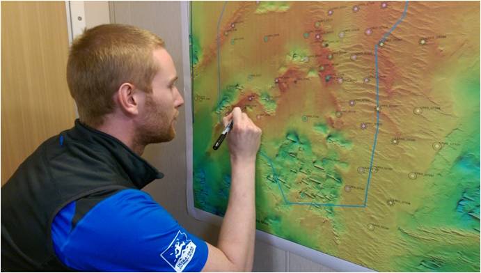
Good morning from the night shift! We’re now about half way through our survey and have settled into life onboard the good ship Scotia, where disadvantages include getting up at midnight and advantages include having a full English breakfast for lunch!

On this survey we are investigating the habitat ‘features’ for which the two nature Conservation Marine Protected Areas (NCMPAs) we are visiting have been designated: the ocean quahog and ‘offshore deep sea muds’. We are gathering an initial dataset on these features which will inform future monitoring and assessment. The goal is to determine whether there are any changes to these features over time.

Arctica islandica captured using high resolution photography © Becky Hitchin, 2015

You’ve already heard a little about the amazingly long-lived Ocean Quahog, or Arctica islandica for latin speakers (
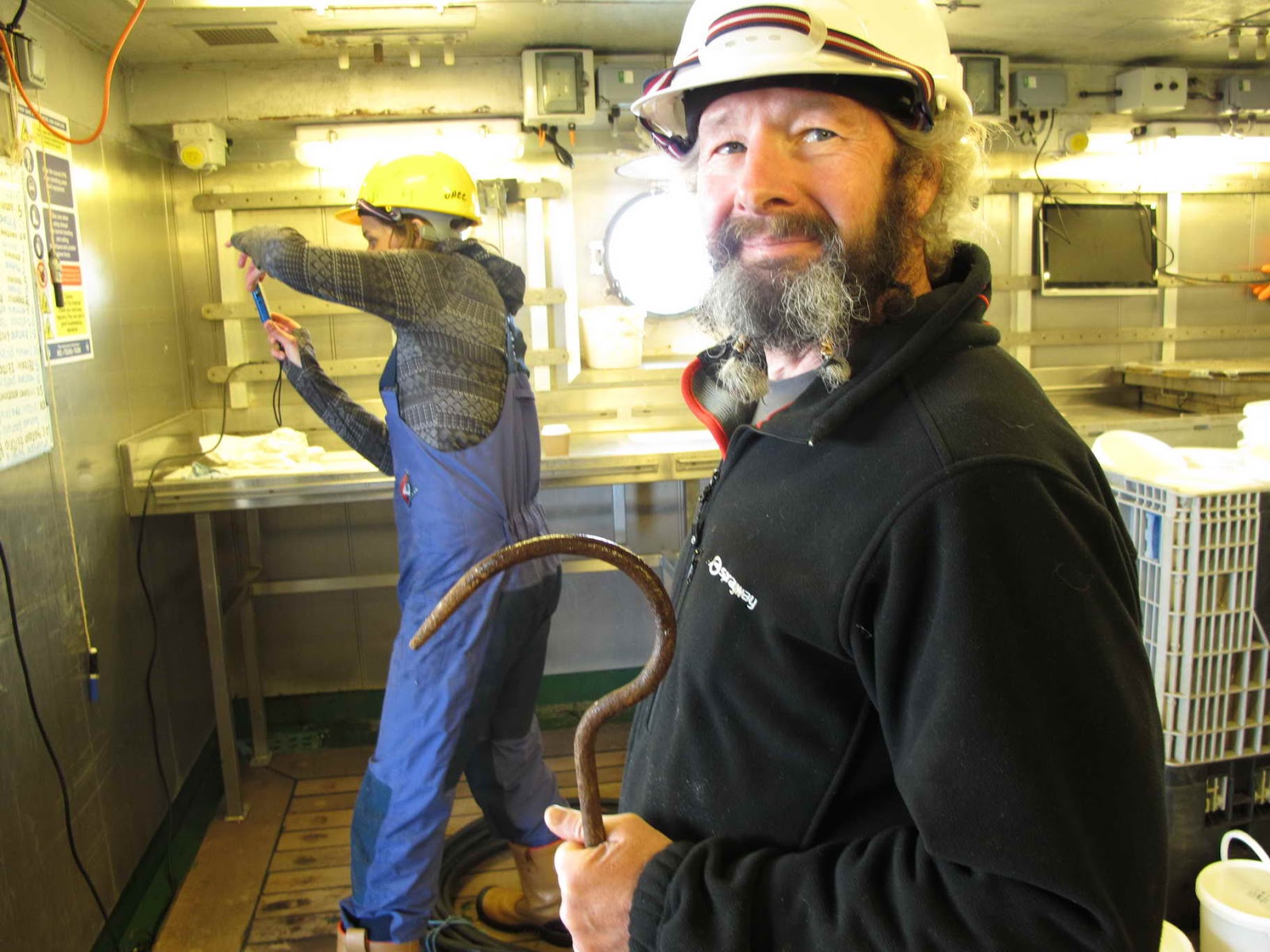
see previous blog post). This clam is typically found buried in sandy and muddy sediment with two feeding tubes called siphons peaking out above the seabed surface.  These siphons are pretty tiny and, although they can be captured using high resolution photography (see picture above), they are very difficult to spot using the underwater camera sledge. It is, therefore, far more effective to record the quahogs using a seabed sediment sampler. Encouragingly, we have already found evidence of quahogs, and have collected both live specimens and many shells in our grab samples.

The living ocean quahog shells are brown in colour whereas the dead ones tend to be mostly white. Any live specimens found within the grabs are measured and photographed by the scientists onboard before being returned to the sea. The shells recorded so far have ranged in size from very small juveniles of less than 1 cm in diameter to adults of up to about 8 cm.

The ‘offshore deep sea mud’ habitat is associated with communities of sea pen (a type of soft coral that grows in the shape of a quill) and large burrowing crustaceans such as Nephrops norvevicus, also known as scampi or the Norway lobster. We have three common species of sea pen in the UK – Pennatula phosphorea which is a very distinctive red feather, Virgularia mirabilis which is straight and upright with white polyps, and Funiculina quadrangularis which is very tall, bowed at the top, and found in deeper waters.


Sea pen images captured using a camera sledge: Pennatula phosphorea (top picture) and Virgularia mirabilis (left in bottom picture) next to another Pennatula. © JNCC/MSS, 2015

As the camera sledge descended for our first tow, we were happy to see a large number of Pennatula sea pens spread across the seafloor, interspersed with a few Virgularia. All our video transects so far have shown evidence of sea pens, and at some stations we have also found high numbers of burrows with the occasional Norway lobster sticking its head out. It is likely that burrows are found in the areas with a higher proportion of mud rather than sand, but we will have to wait for the results of the particle size analysis of the sediment samples to confirm.

We’d better get back to work!

By Megan and Yessica

Monday 26 October 2015

Of (Sea) Mice and Mud

Greetings all from the deck of the Marine Research Vessel (MRV) Scotia, where we are currently surveying in the East of Gannet and Montrose Field (EGM) and Norwegian Boundary Sediment Plain (NSP) Nature Conservation Marine Protected Areas (NCMPAs) with our Marine Scotland Science colleagues.

Sunrise on the MRV Scotia © JNCC, 2015.
  
This first week has gone by quite quickly and has been spent adapting to ship life, where we work in 12 hour shifts to ensure the ship is able to collect scientific data around the clock. As we have spent a good deal of time this year planning this survey, I have really enjoyed this week and the opportunity to get out into the field to test the preparation work completed back in the office!

We have been very lucky with weather so far on this trip, with only 8 hours of ‘downtime’ experienced so far. This, in combination with our hard working crew and scientists, has allowed us to successfully complete almost 200 stations, using the large Hamon grab (pictured below). We hope to complete another 80 or so large Hamon grab stations and 60 camera sledge transects to help our colleagues monitor these sites, providing the good weather continues.

Morning breaks over the Hamon Grab (left) with sieves at the ready (right). © JNCC, 2015.

If you are new to our survey blog you will find earlier posts which detail what the Hamon grab and camera sledge are and how we deploy and operate these.

We have encountered mostly fine-grained, muddy material in our samples, which have contained a plethora of seabed dwelling animals including marine worms, brittlestars, sea potatoes (Echinocardium cordatum), sea pens (Pennatulacea sp.), a sea mouse (Aphrodita aculeata) and some crustaceans. Once aboard, the Hamon grab samples are sieved to remove material smaller than 1mm, and preserved for further analysis back in the laboratory.

 Just a few preserved seabed samples! © JNCC, 2015.

Unfortunately, we have had to dispose of three samples to date and redeploy the grab a second time as the hagfish present in these three samples would not have allowed us to ‘process’ the remainder of the sample. The threat posed by the all-consuming slime of the sampled hagfish is generally sufficiently convincing for marine scientists to redeploy sampling equipment in the hope of obtaining a more accommodating sample!

We have also managed to find specimens of Arctica islandica (also known as the ocean quahog), which is the protected feature common to both sites we will visit on this survey, in our samples. More about that later; now it is time to get back to those sieves... 

By Joey O'Connor 

Tuesday 20 October 2015

JNCC are back at Sea!

Teams from JNCC and Marine Scotland Science are aboard the RV Scotia, in the seas to the east of Scotland, embarking on a cruise to conduct the first monitoring surveys within two offshore Nature Conservation Marine Protected Areas (NCMPAs). Our enthusiastic scientists will spend two weeks collecting seabed samples and photographic data from East of Gannet and Montrose Fields NCMPA and Norwegian Boundary Sediment Plain NCMPA.  These sites have been designated for two features; ocean quahog aggregations (including sands and gravels as their supporting habitat), and offshore deep sea muds.

East of Gannet and Montrose Fields NCMPA and Norwegian Boundary Sediment Plain NCMPA location


The ocean quahog (Arctica islandica) is a large and extremely long-lived species of clam which is typically found beneath the surface of sandy sediments. Ocean quahog are an important food source for several species of fish, including cod, and can live buried deep in the sand for long periods of time without food or oxygen to escape predators. Arctica islandica hit the headlines in recent years for being the world’s oldest animal ever recorded. An individual was collected from the seabed off the coast of Iceland in 2006 that was eventually aged by scientists as 507 years old (link to article). The scientists that collected the clam named it ‘Ming’, after the Chinese Ming dynasty that ruled over China when the animal was born. This means that Ming was four years old when Leonardo da Vinci painted the Mona Lisa and born only 7 years after Columbus first sailed to the Americas!


Arctica islandica and Leonardo da Vinci's Mona Lisa © Creative Commons

Offshore deep sea muds are relatively stable environments which typically support communities of burrowing megafaunal species, such as the commercially important Norway lobster (Nephrops norvegicus), and populations of fragile sea pens.

Large amounts of data are needed to accurately sample the sediment communities at these sites. Weather permitting, the team hope to collect at least 270 seabed samples across the two sites for ocean quahog, with extra camera work where deep sea muds are found. This data will form the first point in a monitoring time-series, which will allow JNCC to monitor the rate and direction of long-term change in ocean quahog aggregations and offshore deep sea mud communities. 


Wednesday 12 August 2015

Onwards to East of Haig Fras

The Cefas Endeavour arrived at East of Haig Fras Marine Conservation Zone (MCZ) at 1am on the 16th May. In contrast to the large bedrock reefs of Haig Fras SCI/cSAC (see blog post), previous surveys of this site have shown that it contains a complex matrix of different sediment types including: rock, sand and mud, as well as coarse and mixed sediments. We planned to carry out 10 minute High Definition (HD) camera tows with still images captured at 30 second intervals and take grab samples using the Hamon grab. At stations that were predicted to be potentially rocky or containing coarse sediments (therefore not suitable for grab deployment) we used the drop camera first to make a visual assessment of the seabed type. It then fell to the scientists to make the final decision as to whether it was a suitable area to deploy the Hamon grab.

                  a)                                                      b)
a) Example of the occasional ‘No Sample’ where not enough sediment was retained to produce an adequate grab sample and b) deploying the Hamon grab on the Cefas Endeavour.   

Despite all of our best efforts in predicting grab-able habitats, sometimes up to three attempts were required to obtain a sample that was adequate for both particle size analysis (a procedure used to determine the size of sediment particles) and infaunal taxonomic analysis (the identification of species living in the seabed).

After long days spent monitoring the video feed from the camera frame, the survey team were happy to get their hands dirty by sieving some sediment!


Day shift lead Simon Pearson checking the sieve for any small marine specimens.

Sieving seemingly endless grab samples requires something of an obsession with marine life; fortunately being on survey is one of the best parts of being a marine scientist! Here are just a few of the species we managed to collect in our samples.

                  a)                                                      b)

                                               c)
a) Nut crab Ebalia spp. b) Red starfish Echinaster sepositus c) Hermit crab Pagurus bernhardus

 Moving away from the obsessions of the slightly eccentric JNCC marine scientists to what this survey hopes to achieve in the broader context. East of Haig Fras was designated as an MCZ in 2013 under the Marine and Coastal Access Act (2009) for three protected features for which the conservation objective is ‘to remain in, or be bought into, favourable condition’. This survey forms part of a longer term monitoring strategy that will assess the change over time of seabed communities in the area, to ensure that the UK continues to work towards conserving these important habitats. Although it seems hard to appreciate (especially when you’re struggling with the Hamon grab at 4am!) each sediment sample collected will be processed, analysed and help to form high quality evidence used to inform environmental decision making at both local and national levels.


A stack of sediment samples prepared for infaunal analysis and an example of the infaunal analysis spreadsheet we will receive when the samples are processed.

It took the survey team a further 10 days to collect the 308 sediment samples and 138 camera tows at East of Haig Fras MCZ but we successfully carried out all of our planned activities within schedule. We even had time left over from contingency planning to return to our first sampling site, Haig Fras SCI/cSAC and re-do some of the camera tows that were initially undertaken in bad weather. Just enough time to sign off with a cheesy day-shift team photograph taken in front of the bridge!


Team photo of day shift. From left in orange overalls (crew): Mike, Mark, Tom and Pete. From left scientists: Charli, Mike (JNCC) Jo, Roi, Jess and Simon (Cefas).


Monday 27 July 2015

To Haig Fras and beyond!

The RV Cefas Endeavour set sail from Lowestoft at 1am on May 9th carrying 15 bleary-eyed Cefas and JNCC scientists, a hardy crew commanded by the seasoned Captain Terry Byrne and enough teabags to see us through our three-week adventure in the Southern Celtic Sea. The JNCC team consisted of JNCC lead Mike Nelson; experienced monitoring scientist Joe Turner; Siobhan Vye, Haig Fras Site lead; and Charli Mortimer, a member of the Marine Evidence Team.


Last view of land for three weeks!

The 12-hour steam to our first site provided no time for rest and we were encouraged into action by the lively Captain Terry, who ordered numerous safety drills to put us through our paces and test our sea legs. In chance moments stolen between muster drills, we set to work constructing what would be the nerve centre of our operations: dry lab HQ, a complex labyrinth of technical equipment and cables concocted (and only truly understood) by day-shift lead, Simon Pearson.


                 Day-shift lead Simon overseeing survey activities and Captain Terry instructing crew.

Amongst such frenzied activity, the Endeavour motored steadily towards our first sampling site; the dynamic rocky outcrop of Haig Fras located 96km northwest of the Isles of Scilly. Haig Fras Site of Community Importance (SCI) is designated due to the presence of Annex I reef and is the only substantial area of rocky reef in the Celtic Sea beyond the coastal margin. The aim for this survey was to collect data to inform the development of monitoring options for Haig Fras SCI and the rocky habitats that are found at the site. We planned to collect data on benthic fauna and environmental variables that will be used to establish a monitoring time-series that can help us to explain long term spatial and temporal patterns in benthic faunal communities found at Haig Fras SCI.

The reef rises to only 38m below the surface at its highest point, where small patches of algae can be found indicating that there is enough light for photosynthesis to occur. With the surrounding seabed reaching depths of over 100m, these variations of depth and substrate lead to an impressive array of marine species. At shallower points of the shoal, the bedrock is peppered with the Devonshire cup coral Caryophyllia smithii and Jewel anemones Corynactis viridis, whilst at deeper depths, boulders and cobbles support branching and cup sponges and the Ross coral Pentapora fascialis.


Simon takes the lead on photo fixing in dry lab HQ.

After getting off to a slow start with a high swell that complicated the positioning of the drop camera frame above the sea floor, the survey team picked up the pace and managed to complete all 91 planned camera stations in five days. This was partly achieved by the usual competitive rivalry between night shift and day shift and a plentiful supply of chocolate. At each station, the team completed a 200m HD camera transect with still images manually taken every 30 seconds using an additional dedicated stills camera. Haig Fras is a beautiful site and there is always a willing scientist on hand to assume the role of ‘photo fixer’, eager to capture some of the stunning marine biodiversity revealed by the drop camera.
                                                                                                                                                                                                       
                           1)                                                   2)  
  3)                                                     

1) Ross coral Pentapora fascialis and Caryophyllia smithii on reef. 2) Jewel anemones Corynactis viridis, hydroids and patches of pink coralline algae. 3) Spiny lobster Palinurus elephas with jewel anemones Corynactis viridis and encrusting sponges.

With all of our planned sampling stations visited at Haig Fras, we steamed towards East of Haig Fras MCZ our second sampling site for this survey.